Keep ArcGIS.
Add verified readiness.
ArcGIS is your geospatial operating system. Cindera is the execution and verification layer for residential wildfire readiness — and we send that layer back into the maps your staff already use.
How the systems fit together
You should not have to choose between ArcGIS and Cindera.
ArcGIS
Hazard • parcels • WUI • FHSZ • incident intelligence
Cindera
Homeowner → action plan → funding → verification → maintenance
Verified readiness layer
Parcel scores, enrollment, and verified outcomes → back into ArcGIS
What the layer contains
Parcel-level features with polygon boundaries when available, otherwise centroids — the same readiness data partners see on the Cindera Risk Map.
parcel_id— Cindera parcel identifierscore— Best available Cindera Score — verified when enrolled, otherwise baselinescore_tier— Tier for score (high_priority → firewise_leader)is_enrolled— Whether a homeowner has claimed the parcelrisk_level— Wildfire risk level from the scoring engineaddress_line_1— Situs address (partner-entitled jurisdictions)geometry_type— polygon, multi_polygon, or point
Endpoints partners use
/v1/partner/gis/jurisdictions/{id}/parcels/export?format=geojsonBearer/JWT-authenticated FeatureCollection download for entitled partners.
/v1/partner/gis/jurisdictions/{id}/parcels/export?format=csvAttribute table with centroids — ideal for joins and spreadsheets.
/v1/partner/gis/jurisdictions/{id}/parcels.geojson?token=cnd_gis_…GIS-token GeoJSON URL for ArcGIS Online “Add layer from URL”.
In ArcGIS Online
Style by readiness priority, then label parcels with score when you zoom in.
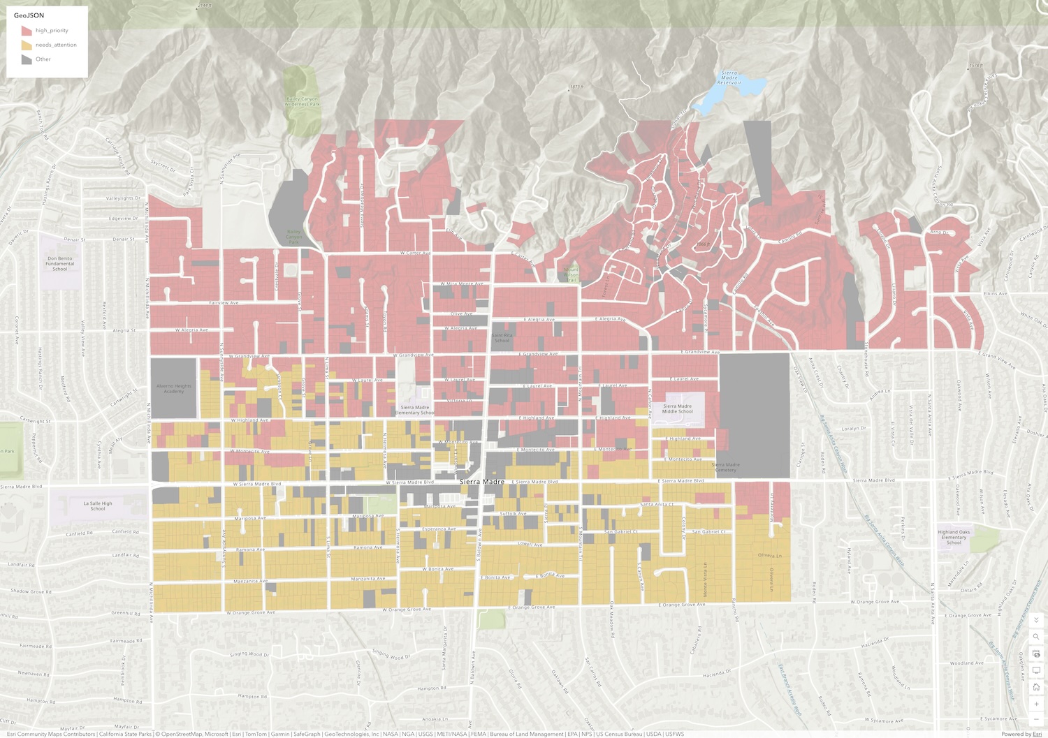
Add the layer in ArcGIS Online
From an entitled partner account, open Risk Map → Share → generate a live URL.
- 1
Open ArcGIS Online Map Viewer
Sign in to your organization’s ArcGIS Online or Enterprise portal and open a map.
- 2
Add layer from URL
Choose Add → Layer from URL. Select GeoJSON as the type.
- 3
Paste your Cindera live URL
Copy the live layer URL from the Cindera Risk Map (Share → ArcGIS) and paste it. Choose “Reference the file from the URL” so the map refreshes when opened.
- 4
Style by score_tier
Symbolize features by the score_tier or score field so readiness pops next to your hazard layers.
Ready to feed ArcGIS with verified readiness?
We’ll scope your jurisdiction, issue GIS tokens, and help your team style the layer.